

So much of bushwalking is a collective knowledge system, passed on through remembering and sharing and doing.
There are lots of thoughts and memories and facts and opinions below. I’ve tried my best to categorise and label them appropriately to help you navigate. Much like recipe-writers surely expect us to skip their SEO-fuel childhood fever dream anecdotes, I hope you’ll take from it whatever you want or need, and leave the rest if it’s not for you.
You may also find value in the actual fever dream that constituted my experience of this track — you can read my full trip report here. If you’re more visually-inclined, you might find this interactive map more helpful.
Please exercise critical judgement and evaluate everything below with a grain of salt. I’m not a wilderness expert — I’ve only been hiking for like…two years. I almost carked it despite all my research. I hope this serves as one possible resource, but take it on board at your own risk.

Track Notes
Walking on Country
The Viking Circuit traces the Great Dividing Range — from Mount Howitt to The Viking — which serves as the boundary line between Taungurung Country and Gunaikurnai Country, before descending south to the Wonnangatta River, on the traditional lands of the Brabralung clan in Central Gippsland, which includes the Mitchell, Nicholson, and Tambo Rivers, all the way south to Bairnsdale and Bruthen.

We agreed waters flowing south are Gunaikurnai and waters flowing north are Taungurung, but that we could also share Country. This builds on our history and stories—of Gunaikurnai travelling over to Taungurung Country for ceremony and the other way round— and shows we are still coming together like our Ancestors did.
Michelle Monk, Taungurung representative, Negotiating a boundary agreement and shared joint management.
As an ongoing result of colonial violence, dispossession, and dislocation, the process of determining custodial ownership and boundary lines is not always straightforward. Colonisation forcibly removed Aboriginal people off their land and into protectorate stations, missions, and reserves. These ‘protection and assimilation’ removal policies separated families and kinship groups, and prevented access to Country, cultural practices, and language. It’s this same colonial logic that has attempted to represent tens of thousands of years of history, stories, and relationships as static lines on a static map, without accounting for how Gunaikurnai and Taungurung peoples have moved and travelled and come together over thousands of generations across the river valleys and the ranges.
In the same way those maps don’t tell the whole story, it’s equally insufficient to say that Taungurung people received recognition as Traditional Owners in 2009, or that the Federal Court recognised Gunaikurnai native title in 2010. It doesn’t account for the fact that sovereignty over these ‘granted’ lands was never ceded, nor the decades of petitioning and campaigning that led to these agreements and legislation. It does not account for the exclusion of freehold title rights from such agreements, nor the ongoing efforts and pending applications for public land that is not currently recognised under those agreements.
In the years since, Gunaikurnai and Taungurung representatives have jointly finalised negotiations over a boundary agreement, which recognises Taungurung as the Traditional Owners of the northern slopes of the Great Dividing Range, and Gunaikurnai as the Traditional Owners to the south.1This agreement includes joint management of the Alpine National Park, in which the Viking Circuit is located. Gunaikurnai people are the joint managers of fourteen parks and reserves in Victoria including the Avon Wilderness Area and Baw Baw National Park, as well as the parts of the Alpine National Park on Gunaikurnai Country. Taungurung people are the joint managers of nine parks and reserves, including Mount Buffalo National Park and Cathedral Range State Park, as well as parts of Kinglake National Park and Alpine National park.


About the Viking Circuit
Difficulty cannot be understated. Physically challenging with constant ascents and descents and at times an actively hostile trail with massive fallen logs and no trail to speak of. GPS is almost a must. […] Otherwise masochists go wild.
AllTrails review, April 2023. Edited for length, emphasis added.
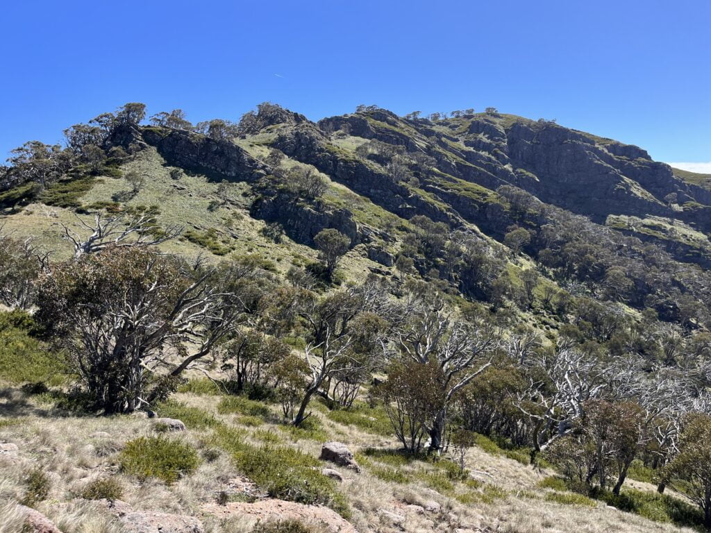
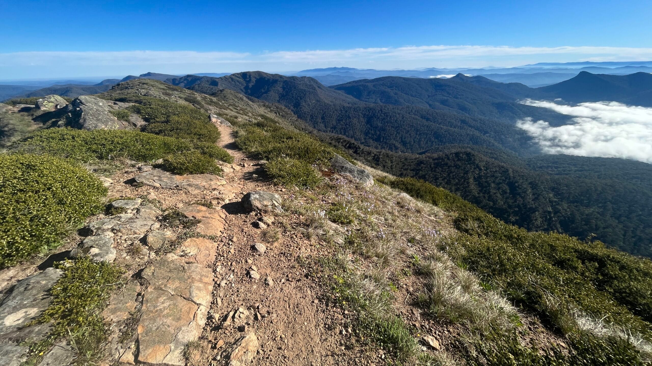
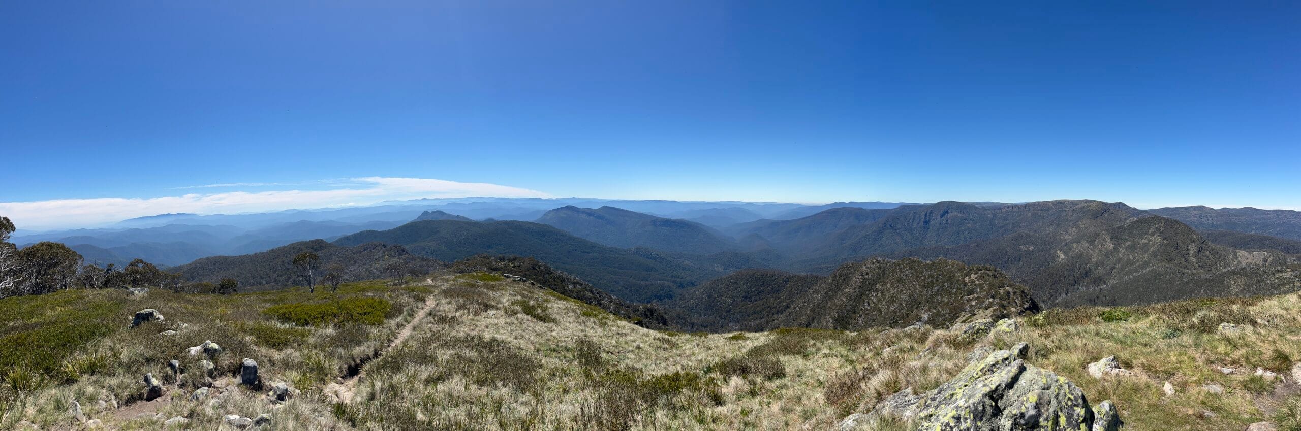
Frequently accompanied by some understated variation of the epithet ‘Victoria’s hardest hike’ or ‘for experienced hikers/masochists only’, the Viking Circuit charts a challenging course through the Razor-Viking Wilderness.
Its ‘dreaded’/renowned difficulty is due to the terrain, elevation change, water reliability, and in particular, its remoteness. The circuit is marked by incredible highs and lows. Literally. So many highs and lows and highs and lows. The most formidable part is not so much the perpetual elevation change, but rather the mental resilience required to endure it. There is pretty much no point where you will feel like you get a brief respite. You’re either going up, down, or nowhere.
The only sections that feel flat will be so overgrown and disorienting to navigate that you’ll wish you had some kind of gradient as a reference point. Navigationally, this route is especially perilous as the track is often blocked or concealed by fallen trees and dense regrowth, or interrupted by discontinuous rock bands.2e.g. The section immediately down from South Viking where you’re moving too slowly through blackberry bushes and fallen trees to notice the gentle decline, the miserable sprawl on the banks of the Wonnangatta River (and its confusing, rarely mentioned network of intersecting creeks and rivulets), and numerous parts of the Old Zeka Track as you’re pushing uphill at a glacial pace. See also: Section Notes.
Aside from demanding you tolerate extreme discomfort, the physical challenge of the Viking is comparable to another hike of similar elevation change. It will, however, be much, much less enjoyable, and much, much more slow-going. You might have more fun running up and down Bogong.

Safety Considerations
You’ll have to read elsewhere for a bog-standard cookie-cutter ChatGPT SEO-friendly hiking guide. I’m not above writing one, but so many have already been written. I would hate to be responsible for anyone else’s safety; you are much better off seeking advice from literally anyone else.
As a first port of call, I’ll recommend Darren Edwards of Trail Hiking Australia. I also rate Andrew Skurka’s trip planning guides, especially his emphasis on researching the conditions. I frequently refer to his recommendations when assessing the viability of certain routes/itineraries I’ve put together myself.

Navigation
Tools
You will definitely want a GPS device of some kind for this track. Although it may seem pointless at times,3The number of times I zoomed in and out of the GPX, only for it to tell me that I was on the track when I knew for a fact that I was in the middle of a literal tree… it’s slightly better to attempt to follow the last-known human traverse than to forge an entirely new one. At the very least, you can put yourself in the way of the possibility of finding the track.
I used an inReach (Garmin GPSMAP 66i) and a Fenix 5S Sapphire in addition to AllTrails/Garmin Explore on my phone. I also carried a map and the Suunto MC-2 G, the one with the mirror.

Track Markers
Trees fall down a lot round here, so I would not rely on track markers as wayfinding tools for the entire route. There are AAWT (yellow) track markers and pink ribbons intermittently on the track, most notably in the section between Mount Despair and the Viking.
The section out of the Viking and down South Viking is marked predominantly with cairns, at somewhat desperate intervals that suggest this section is especially difficult and perilous for walkers. The cairns persist for about as long as they remain visible — for all I know, there are stacks and stacks of rocks buried under all the fallen tree branches and regrowth — but there may be sections where you just have to keep heading downhill and hope for the track to reemerge. At the base of the valley, on the northern bank of the Wonnangatta, you’ll also find yellow spray paint on some tree trunks should you need some extra help. If you don’t find them, then you likely need even more help, but that’s beyond the scope of this guide.
I found multiple turnoff points marked with pink ribbons on Zeka Spur Track, but the turnoff I ended up using was not marked at all, so YMMV here. If you are returning via Old Zeka Track, then good luck. Upon plunging into a questionable divot in the scrub, you may occasionally realise you’re on a human-made track (as opposed to a sambar track) by the presence of rocks underfoot. I presume they have been placed there to prevent trees from growing over the track. An attempt was made.
See also: Decision Points, Section Notes.
Environmental Risks
Bushfires & Floods
I have a notification set up in the VicEmergency app, and the alerts help me get an understanding of certain weather patterns and seasonal risks. I highly recommend you keep an eye on these alerts in the lead-up to your trip. The High Country has suffered its fair share of bushfires (and it’s partly due to bushfire regrowth that this track is so notoriously difficult!) and flooding, sometimes all in the same season!
This has an impact on the road conditions going in, water availability at elevation, and even the height of the Wonnangatta River (maybe more of a concern for me and other short kings). It goes without saying that if the fire danger rating is approaching High/Extreme, please reconsider making yourself a burden on local resources, or creating additional traffic for residents in the area whose lives and homes may be at risk.
UV & Inclement Weather
Storms are not uncommon in summer — and lightning at elevation. Being so exposed up there, the UV is also very high, and you won’t always be under the protection of trees. In the summer, it can get very hot and dry. At the same time though, you’re still in the Alps, so you should be prepared for cold temperatures at night.

Road Access
Depending on where you are in the circuit, there are a limited number of 4WD tracks that first responders might be able to use to get to you, but unless you are basically at the carpark already, they’d still have to traverse the rest of the way on foot.
I do not consider them meaningful shortcuts in an emergency because if you happen to be close enough to Bluff Road, then you’re already close to Howitt Carpark. Howitt Carpark and Zeka Spur Track are proximate only at the start/end of your trip, so again, you’re basically already at the carpark. And then aside from Speculation Road or Lake Cobbler Road (from Whitfield to Camp Creek, 4WD only), I don’t think you can rely on bailing out as an option in an emergency between Mount Speculation and the Wonnangatta River.
For an idea of road access from the closest towns (Mansfield, Whitfield, Licola), have a suss of this interactive map I made here and toggle on the visibility for ‘Road Access’.

Hazards
Depending on time of year and recency of track works, some parts of the track may be may be difficult, near impassable due to overgrown scrub (South Viking to Wonnangatta River, Old Zeka Track).
It may be hard to see see snakes or other hazards underfoot. Could be slippery in wet weather due to the steepness of the terrain or tree debris underfoot.
Some parts of this circuit are incredibly exposed; in particular, the Crosscut Saw is not something I’d want to be picking my way across in dense fog, strong wind, heavy rain.
Includes brief sections of rock scrambling/climbing (between Mount Buggery and Mount Spec, the Viking/South Viking). Because these parts of the track are more frequently trafficked (e.g. the AAWT passes through) there is usually rope in these sections. Neither are super exposed (i.e. you’re not dangling over a cliff) and I had no issues climbing them with my pack, but you may want to haul your pack up before/after you climb up yourself.
See also: Section Notes.
Terrain
Steep, hilly, mountainous — expect 2700m of elevation gain over ~40km. Almost no relief from climbing and descending. You may want poles. I didn’t bring any but I picked up some sticks after South Viking and did not let them go until almost the end. They’re also invaluable for stabbing at the ground when you can’t actually see the ground — how else are you going to check for snakes? I used to be one of those dickheads who was all like, “I’ll use poles when I’m dead!” Yeah, nah. I’ve since acquired some poles.

Remoteness
Reception
I always carry an inReach,4My dad and I share one; he likes buying toys for his 4WD that he drives exclusively in the suburbs, and I like borrowing both the toys and the 4WD so I can go play alone — but safely! — in the dirt. and I would recommend anyone who goes this far out into the backcountry to carry at least a PLB, if not a satnav device.5You can hire a PLB from stores like Bogong and Macpac. If you’re part of a local bushwalking club, then they may have a gear library you can use. It is worth at least $25 a day to not die panicking alone in the bush.
I’m on the Telstra6I’d highly recommend it if you frequent the backcountry. I don’t pay for the full Telstra network, just whatever the cheapest wholesalers get, and my $25/month plan works fine for me. network and I got 4G/some kind of signal at Howitt Carpark (intermittent; nothing when I arrived, but I could send a text out when I got back), Mac Springs, Mount Speculation, and on top of the Viking. Oh, and at the very top of the Old Zeka Track, about 200m from the turnoff for Mac Springs…ask me how I know.
You won’t be able to rely on reception in most of the High Country, least of all out here. Sometimes you can get a signal on the more exposed summits (above the treeline and within sight of Mount Buller is a good benchmark), with SMS being more reliable than phone calls.
Emergency Shelter
Aside from the Vallejo Gantner Hut at Macalister Springs, there are no other emergency shelters or huts on this alpine circuit.


Logistics
Time Window/s
The winter gate on Howitt Road is usually closed from June-October. Before the Queen’s Birthday (or King’s Birthday, whatever) or after Cup Day is your best bet, although the relevant Parks office may announce they’ve opened the gates earlier/later depending on the weather.7If you’re experienced enough to consider doing it winter then there’s likely not much you can learn from me; perhaps the folks here may be able to help you out!
At that elevation, it gets sunbaked and dry very fast. I’ve seen anecdotes in the forums about many water sources being dry by the New Year, but who knows? It’s getting increasingly difficult to predict weather conditions based on previous years. I expect this to become more drastic in the coming years.8At the time of writing (December 2023-January 2024), we’ve just had flooding in Gippsland, but a month ago when I did this walk (November 2023), Viking Saddle was totally dry on both sides.
It might also be worth checking the BTAC website as they regularly recruit for volunteer groups to do track maintenance work! For example, at the time of writing, there’s track maintenance scheduled for Old Zeka Track in late January.9Edited to add that this has been cancelled due to bushfire danger. Well. Good luck everyone.


Navigation
Much of the information I’ve managed to gather about this area has been gleaned anecdotally from the Bushwalk forums or Ski.com.au forums, and from the archives of other local bushwalking blogs.
If there was ever an ‘official’ and comprehensive database of accurate information about bushwalks in Australia, it would have to be Darren Edwards’ Trail Hiking Australia. In the same tenor, the gold standard for this area is the Chapman AAWT guidebook.
Maps
Two maps10I did not request my copy from the NLA in time to get it printed for this trip, but if you are a big nerd (like me), you might also be interested in the Bush Maps Victoria Watersheds of the King, Howqua, and Jamieson Rivers 1:50k by Stuart Brookes. According to the Lilydale map shop, the family does not wish for it to be reprinted as it has not been updated since 2008, and apparently ‘a school’ (no prizes as to which one…) has since bought up all remaining copies. If you are in any way affiliated with Geelong Grammar, please…hit me up. I have questions. of note:
- Vicmap Selwyn 1:50k map for its incredibly detailed contour lines.
- Spatial Vision Buller-Howitt Alpine Area 1:50k for everything else; this is the map I brought with me on the track.

You will be uncomfortable. One of my maxims in life is, “How long can you be uncomfortable for?” If you lengthen the duration of the trip, you reduce the pain.
AllTrails review, January 2022. Edited for length, emphasis added.
Itinerary
The 4-Day Viking Circuit
With almost 2700m of elevation gain over 40km, the Viking Circuit is a physically demanding hike. The consensus recommendation seems to be four days:
- Howitt Carpark to Mount Speculation (~13km)
- Mount Speculation to Viking Saddle (~9km)
- Viking Saddle to Wonnangatta River (~8km)
- Wonnangatta River to Howitt Carpark (~11km)
I can see why this is the most common way to complete the circuit; even broken down like this, your last two days would still be incredibly gruelling. So much so that there’s almost no getting around it — even in the three-day version I completed below, my last two days were essentially the same.
The 3-Day Viking Circuit
I do not enjoy camping, and only do it as a means to an end. I will absolutely try to condense a trip into as few days as I can. For this trip, I could only get it down to about three days, give or take the 5km up to Mac Springs the night before. I can do about 30km a day if the walking is good, but for about half the Viking, the walking is not.
I believe you would want to account for at least a day each for those last two sections based on the distance between campsites, and the unpredictability of the track conditions. If you were extraordinarily lucky, then you might be able to run the whole thing in two days, but I would probably still carry supplies for three because you just can’t guarantee you’ll find enough track to run on once you’re over the Viking.
With the way the campsites are dispersed, I don’t think many people can get away with bundling the section after the Wonnangatta River with anything else preceding it. It’ll take you long enough regardless, and it will suck the entire way, so you want to attack it after a good night’s sleep.
I completed the Viking Circuit over three days, albeit with a 5km headstart up to Macalister Springs the night before. If you are driving in the night before, then you may as well camp up there.11I can’t really imagine driving from Melbourne first thing and then hiking all day, and that’s coming from someone who drove out and back from Bogong for a day hike (24h/8h driving + 8h walking + 4h sleeping + 4h panicking about getting to sleep). But even if I had, I believe it would have been plausible to do the extra 5k on that first day given how early I arrived at Mount Despair.
My actual itinerary:
- Howitt Carpark to Macalister Springs (~4.5km)
- Mac Springs to Mount Despair (~20km) + out-and-back to the Razor (~4.5km)
- Mount Despair to the Wonnangatta River (~13km)
- Wonnangatta River to Howitt Carpark via Old Zeka Track (~10km)12…allegedly…so I don’t know how I ended up with 18km on my Garmin?!
If you’d like to read more about each section, check out the full trip report here.
My thinking was that I’d knock out as much walking as possible with the heaviest packweight while the going was good; up to Mount Speculation is generally good walking, and up to the Viking should be straightforward enough to navigate.
I originally planned to make it to Viking Saddle the first day, and probably could have made it if I’d skipped the Razor, but I didn’t find I needed more daylight on the second day (just more water!!!), no matter how bad the bushbash. Also I suspect the counter-clockwise group must’ve camped there the night before, so I’m glad I dropped pack at Mount Despair.13Note the Mount Despair campsite is relatively small; I have a 1p tent because I’m not much to speak of myself. There was room to eke out one more, but it would have been intimate. If there had been even one more tent there, I would’ve definitely bailed for Viking Saddle.
I didn’t feel like I ran out of time on any day,14But I acknowledge people saner and wiser than I am would choose to set up camp a lot earlier than I usually do. not even the last; that I did run out of time was not due to the distance travelled, but rather my own poor judgement on every other count.

Water Sources
Your three most reliable sources throughout the year (listed in order of water flow from least to most) will be Mac Springs followed by Camp Creek, and of course the river. You should be prepared to carry water all the way from Camp Creek for approximately 21km through very rough terrain. Depending on how you slice and dice your itinerary, it may take you in excess of a day to walk from Mount Speculation to the Wonnangatta River, so this is no small undertaking.15Looking back, I really should’ve done this — and I’d brought along two extra bladders for this purpose! — but I did not at the time because the extra weight would have made my total packweight too uncomfortable a proportion of my bodyweight (+10%). Obviously this scales with size, so it might be negligible to someone else to carry the same amount (5L), but if you’re anywhere within the range of ‘petite’ then this could become prohibitive.
This is very dry country16You can look up the amount of rain Buller received in the weeks preceding my trip in the second week of November 2023 if you really want to quantify it, but I’d almost say that if the weather is nice enough for you to leave the house, don’t bother with Catherine Saddle or Viking Saddle. It’d rained enough in the week leading up to my trip that I even called the Heyfield DEEC to ask about the condition of the road going in. But when I got up there, Viking Saddle was dry on both sides. already, and I don’t expect it’ll be much improved from here on out based on recent trends.
The ones listed below are the main water sources, clockwise from the trailhead. Depending on your tolerance for disappointment and your skill in navigating the bush, you may find water elsewhere on the route, but it may involve descending from the ridgeline for god knows how many metres/kilometres.

- Macalister Springs
Location: A little further down from the hut as you’re descending on the track. Unless you’re me, you should not have trouble finding it.
Distance from trailhead: ~4.5km
Distance to next water source: ~8.5km (Camp Creek)
Reliability: Good year-round; some years it’s slow (e.g. March 2023), but so far I have not seen any reports that it has ever stopped. It was running well when I was last there (November 2023). - Camp Creek
Location: Down on the other side of Mount Speculation. It’s not far from the campsite; you’ll need to walk just a little further along the wide 4WD road to find a culvert. I don’t remember how far; I don’t think it was even 5min? “Then turn left (west) on the road for 20-30 metres, creek will be on the left. If you reach the hairpin bend on the road (100m?), you’ve gone too far.” (madmacca, Bushwalk.com, February 2015)
Distance to next water source: ~3km (Catherine Saddle)
Distance to next reliable water source: ~21km (Wonnangatta River)
Reliability: “Camp Creek is very reliable. There’s a nice little watershed for a few hundred metres distance up the creek, and reasonably wide slopes on both sides. Only after the driest summers would Camp Creek cease to run.” (Lophophaps, Bushwalk.com, March 2018.) It was positively gushing when I was there (November 2023).
Note: I’ve heard some reports that the water is a bit compromised on account of the 4WD access and uh, people pooping too close to it. Do what you will with this information. - Catherine Saddle
Location: Further down the old Speculation Road, SE of the campsite. I did not personally access this water source, so I don’t know how hard it is to find. Because you’re venturing down a lesser-used part of that track, it might be a bit scrubby. The most specific instructions I could find: “If you walk down this track for 15 or 20 minutes you will see thickly clustered ferns beside the track and on the side of the hill. There is often (but not always) water under these ferns from a seep on the hillside.” (festinare, Timbo.id.au, 2014).
Distance to next water source: ~6.5km (Viking Saddle)
Distance to next reliable water source: ~12.5km (Wonnangatta River)
Reliability: I’ve seen it referred to as a ‘trickle’, ‘a little soak’, or a ‘seep’. Doesn’t sound promising. Considering how close it is to Camp Creek (which I have now described thrice as ‘gushing’) you might be better off there rather than having to backtrack. - Viking Saddle
Location: From the campground, it should be pretty easy to find the footpads leading off either side of the saddle. Apparently the better one is the one to the NE, so you might want to try that first.
Distance to next water source: ~6km…but that’s 6km over the Viking and then through some terrible scrub.
Reliability: Lol no. I went down both sides, all the way down, until I couldn’t go any further. Dirt was a bit damp in some places, but no water running. From other reports, it seems the water off the saddle comes from a spring further up that requires quite a bit of rain to recharge, so it’s not uncommon for it to be dry. - Wonnangatta River
Location: You can hear it from the campground. If you can’t figure this out then I urge you to please reconsider this hike.
Distance to next water source: This depends on which track you’re taking back to your car as you may bypass Mac Springs altogether, but either way you’ll want to carry enough water to get wherever you’re going as there’s nothing on your way. I cannot for the life of me remember if there’s a water tank at the Howitt Carpark, nor is it the type of thing anyone else would typically mention since it’s so close to Mac Springs. I usually keep an extra 10L clean drinking water in the car.
Reliability: Not that rivers can’t dry up, but if this one did, then you’re probably not hiking this circuit at all because the entire region would be torched.
Campsites
The sites listed below (clockwise from the trailhead) are the obvious sites you’ll encounter on your way.17For the sake of exhaustiveness, I will also flag that between Mac Springs and Mount Spec you also have SNS Saddle and Mount Buggery, but they’re probably not going to be useful to you on this particular circuit no matter your itinerary. They’re too close (within 2-3km of easy walking) to Mac Springs and Mount Spec respectively, both of which have access to water. I say that, but then Spec/Catherine Saddle/Mount Despair are also within 2-3km of one another — not so easy walking, however. I do also recall reading something about a small tentpad closer to the Viking outcrop, but I was too busy suffering to keep an eye out that morning and cannot independently verify where it is or whether it’s still viable. None of the sites require booking or payment. In fact, you’re actually allowed to wild camp anywhere in the Alpine National Park. But I’d probably stick to the known sites if possible. There are just too many tall trees and big branches hanging overhead everywhere else.

- Macalister Springs
Shelter: Yes, Vallejo Gantner Hut.
Water: Yes, Macalister Springs.
Toilet: Yes, a “loo with a view” rivalling only Devil’s Kitchen.
Distance to next campsite: ~8km (Mount Speculation Summit)
Notes: It’s a popular site because it’s so close to the carpark, and it’s the only one with all the modcons. It’s also got the very photogenic hut. Outside of peak seasons, I don’t think you should have any problems finding a spot. - Mount Speculation & Camp Creek
Shelter: No.
Water: Yes, Camp Creek.
Toilet: No.
Distance to next campsite: ~2.5km (Catherine Saddle)
Spec is quite spacious, but it’s also very popular. I did not camp here, but there are some flat bits near the summit that look like they’ve been used as campsites, although they may be quite exposed.
Camp Creek proper is ~500m further, on the other side of Mount Speculation. This is another campsite that is more sheltered from wind/the elements, and closer to water. This site is accessible by 4WD via Speculation Road. - Catherine Saddle
Shelter: No.
Water: Yes, but see Water Sources.
Toilet: No.
Distance to next campsite: ~2km (Mount Despair)
For the number of people who probably pass through here, I doubt it gets crowded. It’s so close to Mount Spec that it’s practically an overflow parking lot — although not quite, because despite the short distance, the track after Spec is not as clear. It’s a fairly large and peaceful spot. I did not camp here but it’s commonly recommended as part of this circuit. - Mount Despair
Shelter: No.
Water: No.
Toilet: No.
Distance to next campsite: ~4km (Viking Saddle)
This campsite is quite small; I think you’d not want more than two, at a push three tents here. Even one is plenty cozy. If you are doing it in four days then it’s easy to avoid this one. It is close to the turnoff for the Razor, if that’s something you are interested in adding to your trip. - Viking Saddle
Shelter: No.
Water: Yes, but see Water Sources.
Toilet: No.
Distance to next campsite: ~6km (Wonnangatta River)
Quite large, similar in vibe to Catherine Saddle. I believe Timbertop uses this one as they have a Nalgene here. I didn’t camp here but there were some big rocks around that I used for drying my rainfly while I failed to retrieve water from either side of the saddle. Happy days. - Wonnangatta River
Shelter: No.
Water: Yes, the river.
Toilet: No.
Distance to next campsite: If you’re going clockwise then you should aim to get back to your car in one day rather than stopping again. I did see some extremely creepy remnants of a campfire and other signs of camping on the Old Zeka Track if you’re desperate. I was desperate and even then I didn’t want to stop there.
Spacious and lush and easy access to water. It’s the only water source where you can have a proper swim instead of waiting an hour for a trickle to fill up your bladder. It is accessible from the Zeka Spur Track but it’s still a bit of a trek (and a river crossing) from the road so I am not sure how much traffic it gets from 4WD campers since it is definitely a ‘hike-in only’ site.
I mean, someone did crash the campsite at 2am when I was there, so maybe it’s quite popular. It didn’t look overgrown in the slightest, and the river access would be quite a draw. But otherwise, the only other access point is via the track down from the Viking, and not even AAWT walkers use that — I imagine it’s almost exclusively for those completing the Viking Circuit.

Track Conditions
Not all tracks are reflected across all maps, nor is their inclusion in one particular edition indicative of their present-day viability. For this reason, I have tried to include dates for any reviews/track notes I am quoting from other sources. Please see Section Notes where I’ve flagged the parts of the track most likely to vary in their condition.

Road Conditions
The usual starting point for the Viking Circuit is via the Howitt Carpark, although you can also get onto Mount Howitt via any of the tracks starting at the Upper Howqua Campground.18It adds quite a bit to the journey, so this is the only report I could find of someone who’d actually done this version. Howitt Carpark is accessible via Tamboritha Road.
Coming from Melbourne, it took me about 4 hours to reach Licola, which is the town at the start/bottom of Tamboritha Road. Depending on road conditions, your tolerance for intense vibration, and the amount of clearance your car has, it can take an additional 2 hours from Licola to the Howitt Carpark. If you’re driving up this way at night, be on the lookout for sambar.
Access to the Howitt Carpark trailhead is sketchy at the best of times, but both Tamboritha Road and Howitt Carpark should be doable in a 2WD in fair weather; just don’t expect to get past first gear very often. If there’s been a lot of recent rain, I’d say you’d want at least a Subaru, or something with a bit more clearance, like a CRV. Heyfield DEEC does the best they can grading the roads, but it doesn’t seem to last long. If not rain or snow, it’s still a popular thoroughfare, especially for 4WDs.
Decision Points
Circuit Direction
What: Clockwise or counter-clockwise?
When: Probably a good idea to decide before you start…
The Viking Circuit can be completed in either direction. For an idea of what to expect if you do this counter-clockwise, or even if you aren’t, I found this to be an insightful resource (last revised 2020).
I knew from the trip intentions book that a party of four had started earlier that day going counter-clockwise. Given how late I started, I doubt anyone else started on the same day. I did not see another soul past Mount Speculation, but right before the drop down to Camp Creek, I did bump into that group.
I also chose to complete the circuit clockwise because I prefer to do the crappiest walking at the very end. That way, I’ll be glad to get back in my car and back to Melbourne! If I have the best walking at the end, then I’ll be sad about going home. Coming from an apartment building on a main road, it also takes me some time to acclimatise to being in the bush; having done the part up until the Crosscut Saw, the clockwise route eased me into things as the going got tougher and more remote.
It’s hard to say whether it’d be easier or harder to find Old Zeka Track going downhill versus uphill, and same goes for the scrubby bit straight out of South Viking. I suspect it depends on the year/time of year; I also suspect it kinda sucks all the time, no matter which direction you do it in.

Old Speculation Road
What: Old Speculation Road or the AAWT to Catherine Saddle?
When: Camp Creek, at the foot of Mount Speculation.
There are two tracks you can use to get from Camp Creek to Catherine Saddle: Old Speculation Road, and the AAWT. I ended up taking the old 4WD track, in part because it was what was marked on the AllTrails map I was using, but mostly because I looked at the contour lines and decided to choose laziness.19I’m not usually one to choose the flat 4WD road, but there’s nothing I have to prove on that point; just choosing to do the Viking Circuit suggests an unfortunate preoccupation with climbing big hills and arboreal melee combat.
This is one of the reasons I struggle to trust AllTrails maps in isolation;20If you were just going off the GPX, it might be confusing if you hadn’t done much reading on this beforehand, because your expectations for the ‘easier’ track might be incorrect. The AAWT is generally better maintained than many other tracks in this area, and likely sees more traffic than most of them. If you saw a track marked ‘AAWT’ anywhere else on this circuit, you’d be right to feel relieved. it’s hard to trust a divergence from a known/named track because of some community/heatmap algorithm. But in this case I think the AllTrails map pointed me in the right direction, and I’d say the AllTrails map for this particular route to be as good as any, provided you do your due diligence to find up-to-date reports to inform the existing GPX file.21For this track in particular, I would strongly suggest you do not rely on any given GPX as your sole navigational aid without doing some research as to what’s currently viable; just looking at the track and the elevation does not give you enough information about what to expect, but hey, if you’re reading this, then you probably already know.
Expand for additional notes.
Recommend taking Speculation Road. The path to Despair is very doable and is a bit overgrown past Camp Creek but still very passable and easy to navigate.
AllTrails review, February 2023. Edited for clarity.
The trail down to Catherine’s Saddle was barely visible and overgrown. Even with GPS maps we went off trail a few times. It’s a really fun descent and I reckon worth the adventure if you’re up for it.
AllTrails review, April 2021.
Would recommend taking the ‘Speculation Road’ from lower Camp Creek to Catherine Saddle. We didn’t […], was tough to get through that section along the Aus Alpine Walking Track, no path was found at any point, very heavy brush on a slope.
Trail Hiking comment, March 2023. Edited for length and clarity.
The descent from Mt Speculation to Catherine’s Saddle is a flat out bush bash. We met two other groups afterwards and everyone told the same story; no trail and a scramble down the hillside over trees and through assorted saplings and low level growth. Wearing shorts and gaiters, our bloodied knees were evidence of the messy conditions. While it was a heap of fun, it took us a lot longer than we had anticipated and we expended a lot more energy and consumed a lot more water than we had planned.
AllTrails review, January 2023. Edited for clarity.

Old Zeka Track
What: Continue taking the active, clearly-defined 4WD road all the way back around to the carpark, or chance the old, overgrown 4WD track back via the turnoff for Macalister Springs?
When: On Zeka Spur Track, whenever you start having an opinions about it.
I am a little biased against the decision I made, and that seems to be the general theme I found in my research: no matter what you choose, you will probably think you made a bad decision. Because the reality is that there are no good decisions here. It all sucks. But my bias is for the known evil.22Other parts of the Viking are similarly overgrown from lack of traffic, this section was especially bad for me. Maybe it was the fog. Maybe it was the rain. Maybe it was the fact that it looks eerily like a once-trafficked, now-abandoned 4WD track. If the section out of South Viking feels like standard seasonal regrowth, with short and uncontrolled eruptions in fits and bursts, then the deterioration of the old Zeka track feels perversely ancient and persistent. And it’s all very deceiving; because of the steeper elevation drop and the higher frequency of towering gums, South Viking is a bit of a green tunnel at a glance, but upon closer inspection, it’s possible to eventually discern some kind of a track. Whereas many parts the old 4WD track appears clear and open in that you can see very far (even with the fog) due to the very gradual, barely perceptible incline, and many more trees have been cleared for the old road, but in reality, the scrub is approximately my height (apparently that’s ‘chest-high’ for the rest of you) and impenetrable.
If you’ve left yourself a full day to do the section out of the Wonnangatta River, then you’ll have ample time to decide between a) the devil you know (with a possible bail-out option), and b) indeterminate hours of ambiguous suffering through dense regrowth (hours away from anyone who wants to — or could even be paid to — rescue you).
The only people who don’t have a bad word to say about this section are the brave and noble souls who cleverly accepted a goddamn ride from a 4WD. To keep this option available to you for long enough that you can convince yourself to accept such a blow to your self-esteem, you must be on a track that is traversable by 4WD.

Whatever decision you do end up making will likely depend on:
- How much daylight you have
- The conditions of that particular day
- How wrecked you’re already feeling
- How many 4WDs are kicking up dust as you walk
- Your relationship with your own pride
- Your willingness to accept a ride on your last leg of a walk
- The availability of said ride
- How willing you are to gamble your life/comfort/sanity on a guaranteed sufferfest in exchange for walking slightly less in kilometres/elevation, albeit infinitely more slowly
That’s why I’m telling you there’s no medal or magic at the beginning, middle, or end of the old Zeka track. Seriously, there’s no view, there’s no reward, there’s no point.23If you are fanging for the feeling of relief after a protracted period of suffering, you might try putting your hand on the stove and then removing it. As my partner said to me after the old Zeka track spat me back out in the pitch black pouring rain of night: “Don’t be a hero.”
Although this track is earmarked for maintenance by BTAC, there are simply too many things that can happen from one year to the next that might render all that effort and work redundant — if it can go ahead in the first place. I don’t know how often this section gets attention, and I don’t know if any other routes use this track. It seems very, very unlikely.
Expand for additional notes.
From the river we had two options; follow the old vehicle track up to the Zeka Spur 4WD track and trudge through the dust, or cut up an unnamed and untracked spur to intersect the main spur above the 4WD track. We opted for the former, in case we could hitch a lift, and to avoid any regrowth issues.
The Zeka Spur track is one of the main 4WD access routes into the remote Wonnangatta valley […]. Consequently the track and all the vegetation either side is covered in dust, with the lingering scent of diesel in the air. [The track is] steep, uninteresting and generally unpleasant. Only two vehicles passed us going in our direction, and neither stopped. The rest of the traffic was heading down the hill. At one stage a vehicle pulled over and a lady called out, ‘Are you guys intentionally walking?’!!! Says a lot about the 4WD mentality. […] We came across a couple of walkers camped in a saddle, who had walked down the track to the Wonnangatta the previous day and marched back out again that morning. One of them described the ascent as ‘soul destroying’.
Pauciflora Adventures, April 2012. Edited for length.
The next four hours were most unpleasant. These were spent walking up the steep dirt road with a large number of 4WD cars and motorbikes passing by. Highly recommended to find an appropriate ridge up stream, likely to be a bush bash but no doubt much nicer than the Zeka!
victramping, May 2015.
A final day leg consisting of 1000m of ascent after climbing multiple peaks is just brutal – like why???
AllTrails review, April 2023.
Actually, I’m not sure if someone is taking the piss. This ‘track’ on the spur must have last been used approximately one million years ago. There is a track there, but I only saw it about three times for about ten feet, before it vanished again. In the end, I gave the finger to looking for the track and opted to head up following the ground with the least resistance.
It’s hard to describe, but I’ve never stepped over or gone around so many fallen trees in my life. It was a complete fallen tree-arama.
[…] Actually, if you have a friend with a 4WD, I’d say leave it down near the Wonnangatta River. Avoiding the entire Zeka Spur slog would be a blessing. Maybe if the final day hadn’t happened, I’d have nicer thoughts about the overall walk! There is nothing to add, but the last day pushed the boundaries of crapola.
Hiking Fiasco, December 2013. Edited for length.
It was kind of nice to bulk out some ascending on a wide open road before heading back into the bush for the mental and physical beatdown of the final ~6kms of the Old Zeka Track. The entrance off the road isn’t marked so watch out on your maps after the switchbacks for a place to scramble up to the ridge. ‘Old’ is an understatement for this track’. We were bashing through chest high, thick bush for a good three hours here. Every now and again coming into a clearing only to be brought back into heavy vegetation and fallen trees. A real adventure! Keep an eye on your GPS because this is in no way clear or easy.
AllTrails review, April 2021. Edited for clarity.
Then there was what the map showed as a walking track from the Zeka Spur Track (a fire trail) to the Mt Howitt Walking Track. It is a conundrum. Let me put it like this: A lot of ‘discovering’ occurred on the way. Certainly, the park’s rangers know nothing about this Mystery Road. And—apart from a 500m pad I discovered and clung to as a drowning man would to a life raft in a churning sea—it was unadulterated, off-track, scrub-haggling.
I was hurled into the vortex as spectator, protagonist and victim. The topo was telling me one thing, terrain another. […] And as for trees, was it really necessary for so many of them to have toppled?
Wild, issue #187, March 2023. Edited for length.
I am not joking when I say our speed dropped to 1.5km/h as we had to wade through dense blackberry bushes and all manner of thorny plants. Many a time our GPS would say we were on the track and my buddy and I would say, “Where the hell is the track?!” Zeka Spur Walking Track on the final leg is particularly over grown; we were so battle hardened by that stage that we just endured and pushed forward.
AllTrails review, January 2022. Edited for clarity.


Section Notes
There are many variables that may affect the condition of the track, e.g. bushfire, flood, recency of track maintenance, the particular weather that day, the particular weather that season…
I wanted to include some ‘leftover’ notes and comments from other resources that I came across in my research. Their reports did not reflect my own experience this time round, but I have compiled them here as a reference as they may be useful to help you get a sense of what you can expect.

Mount Despair to Viking Saddle
The section down to Viking Saddle showcased some exemplary chainsaw work; had that not been so recently done, I would have enjoyed it even less than I already didn’t. If there’s been recent track works, then you’re in for a steep but steady trudge. Otherwise, I expect you’re looking at the world’s slowest steeplechase course.
Expand for additional notes.
Scrambling along a rocky ledge and through thick correa while trying to stay on course was really tough going and we were pretty bashed up by the time we got through. 1.5km/h kinda stuff. We found the trail again and figured we were now set for a cruisy downhill into Viking Saddle. Wrong. There’s a stretch of about 300m that is littered with fallen trees (probably the result of the storm with the massive winds; was it 2020?). It was really slow and hard work climbing over/under/around the trees and, again, we spent many more tickets and drank much more water than we had planned to.
AllTrails review, January 2023. Edited for clarity.

The Viking Rock Chimney
There was a rope when I was there, and most recent accounts mention a rope as well. It’s not the most popular track, but it’s notorious enough that it does get regular traffic, especially as this section is a part of the AAWT. Nonetheless, for the sake of being exhaustingly exhaustive, I’ve included some guidance from others on how you might ascend without a rope, because nothing is ever guaranteed. The Viking will still be there if a fire rips through the area, but ropes are particularly prone to degrading. I do think this is an important consideration; it’s dangerous to rely on assumptions about these remote areas, so it’s worth knowing.
Expand for additional notes.
BTW, there is now a rope in the hole on the climb up the Viking — although the reason why escapes me. It’s much easier (and faster) to climb around and over the log (on the true right).
bernieq, Bushwalk.com, April 2018.
Going up the chute, before moving under the chockstone that forms the hole, move left (to the true right) and climb around the nose of the narrow rocky bit, then climb up and over the big log (with a notch for your foot) wedged in the crevice. It’s easier than climbing up the hole (with or without a pack on).
bernieq, Bushwalk.com, May 2018.
Ropes deteriorate with age. Ropes that are in situ should not be relied on for support by people. I’d risk such a rope for packs, but that’s all. Without a pack the ascent and descent is straightforward, and I have never used a rope to assist progress up or down. I use the true right chute on The Viking.
Lophophaps, Bushwalk.com, May 2018.

South Viking to Wonnagatta River
In my trip report I’ve mostly referred to this section as ‘the bit coming out of South Viking’, but I suspect the following applies to the section down near the bank of the river as well. I experienced the worst bushbash in the section immediately down from the ridgeline, before the decline really kicks in, but it seems like I should consider myself lucky!
I do remember noticing the yellow spray paint arrows and being amused that they’d bothered to mark the one section I’d struggled with least that afternoon, but their presence suggests my experience is not the norm.
Expand for additional notes.
The coy Wonnangatta River valley lured hikers to come off the forested ridge prematurely. If seduced, one would find themselves fighting the near-impassable, blackberry thicket for the rest of the journey.
We Are Explorers, November 2021.
So with exhausted legs, dampened spirits, and a longing to reach our campsite on the tranquil Wonangatta River, we fell through the bush. Stood up, took two steps then fell through the bush again. For the next three hours this was the routine until finally we stumbled onto an escarpment overlooking the river and our potential campsite. Sounds great doesn’t it! The reality was that we had hiked slightly off to one side of the spur and found ourselves high above the river with nothing but blackberries below.
Trail Hiking trip report, October 2016.
This was the start of an insanely frustrating time. It’s one of those places where you can’t really get lost, just keep going downhill and you’ll hit the river sooner or later, but we were pressed for time. The sun was getting low and the rocky, grassy terrain was sending me slipping and sliding, before generally face-planting. […]
I’ve no idea what happened next, as I’ve tried to eliminate it from my memory bank with extreme electro-shock therapy. Keep in mind the next photo is the last one I took for the day at 6.12 pm. It’s when we first started entering some head-high regrowth. […] About a kilometre from the river it was pitch black, thick saplings blocked our path and walking in the dark is always tricky. Especially on a steep slope, covered in rocks and fallen trees. […]
We ended up walking in circles before the General called a halt in the proceedings and by utilising his rank, guided us down to near the river. Somehow, we popped out into an opening with a postage stamp-sized piece of ground to set-up out tents in. […]
Oh yeah, remember the four to six hour suggested time from Viking Saddle to the Wonnangatta River? How about 10 hours?! […]
I have the GPX track if anyone wants it, but I suggest you don’t, as a closer inspection will show some truly bizarre behaviour near the river. It’s a crazed track, which thick bush and no light causes.
Hiking Fiasco, December 2013. Edited for length.
From here I descended a long, scrubby spur to the river. The route was quite overgrown in places and I had trouble with route finding in places. This became increasingly difficult as the twilight brought increasing limited vision and the scrub seemed to grow more dense.
At around 8:15, when it became totally dark, I was a few hundred metres above the river. I could even hear it. However, the bush at this point was both thick and high (about 3-5 metres), making it really hard to navigate. […] I then crashed, bashed this way and that way to eventually find myself within 10 metres of the Wonnangatta. The only problem now was a dense row of blackberry bushes between me and the river! I went up and down the river to find a way through and, finding no easy path, used my walking stick to bash a way to the river. It was 9pm when I finally made it!
Trails and Tracks, December 2013. Edited for length and clarity.

References & Additional Resources
For the most up-to-date reports on access to the area:
- Check the Parks Vic page for the Howitt Road trailhead for information about road or park closures, e.g. due to landslide, aerial shootings.
- Check the BTAC website for an idea of when track maintenance was last performed.
- The relevant Department of Energy, Environment, And Climate Action (DEEC) branch for this area is the Heyfield office.24They will be able to put you in touch with the local park rangers should you need. I highly doubt they frequent much of the Viking Circuit (to be fair, I don’t think anyone does). They manage the roads to the trailhead, i.e. Tamboritha Road, Howitt Road, and Zeka Spur Track.

I am deeply grateful to the wealth of trip reports from other walkers in the years and decades past:
- Wild, issue #187, March 2023.
- We Are Explorers, November 2021.
- Timbo.id.au, 2014 (last revised 2020).
- victramping, May 2015.
- Goin’ Feral One Day At A Time, February 2015.
- Hiking Fiasco, December 2013.
- Trails and Tracks, December 2013.
- Pauciflora Adventures, April 2012.
I’m probably missing some as I did most of this research months before I ever considered writing my own trip report, but at the very least you can consider this a chronological list of works cited.

For live feedback from locals and other hikers:
- The folks on the Vic Hikers and Australian Alpine Walking Track groups on Facebook are both active and helpful, with many experienced members who have walked extensively in this area. The recency here is in the days/weeks.
- I’ve never had to make a new thread because the existing threads are already so valuable, but I imagine if you did, you’d get some great answers on the Bushwalk forums or Ski.com.au forums.25Some of these members are in the Facebook groups listed above, mind you, and while the members of these forums will definitely have the best historical information about the track and may be able to tell you about patterns/what to expect, they might not have been there within the last month. One does not simply do the Viking Circuit/AAWT on a yearly basis.
- New comments on the Trail Hiking page or new AllTrails reviews26The reviews tend to be more brief, so you might not find the information you need about water sources or road conditions going in, although for this track specifically, you will surely get some feedback about the track conditions (just because there’s usually at least one part of it that is guaranteed awful). can be a decent reference, but there’s typically only a few per season so I’d only consider them ‘recent’ relative to a years-old trip report or forum thread.
- If you, like me, prefer to cast a broad net and keep an ear close to the ground, then it can be worthwhile to follow/join local community groups, 4WD groups, mountain bike groups, etc. on Facebook. Emergency services (e.g. SES, CFA, police) and the press outlets (mainly the ABC) in the region can also give you some intel, but it’s usually less local. Big news is typically reposted in other groups anyway, although that being said, those pages can still be useful resources because people may contribute further details in the comments.
In addition to searching for information about “The Viking Circuit”, it’s also worth keeping an eye out for reports about relevant areas nearby, e.g.
- AAWT (Mount McDonald — Barry Saddle)
- Mount Speculation
- Mount Howitt/Crosscut Saw
- Licola/Tamboritha Road/Moroka Road
- Mount Buller/Mount Stirling
Leave a Reply